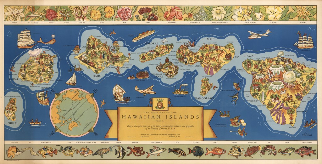
If you like maps, and you like Hawai’i, then you should take a look at my 2015 article in Cartographica, “Eight Islands on Four Maps.” It examines maps from the different stages of Hawaiian political history — Kingdom, Republic, territory, and state — to show how each government sought to use maps to define the islands and their people in the American imagination.
You can find it here.